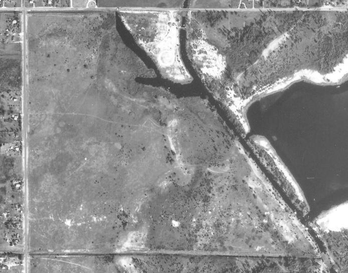
A few weeks ago, I wrote about wanting a time machine to go back and see how Palm Beach County looked decades ago. I have often thought how cool it would be to have “ancient” Google-maps, to be able to have a bird’s eye view of your property. Well, you can. Thanks to a project by the University of Florida, you can find out what your property looked like decades ago. Depending upon where you live in the county, there are maps posted from 1940, 1953 and 1968.
I stumbled across the link on the Palm Beach County Property Appraiser’s website. I looked first at the property where my house resides. I was lucky in that there is a house along Lawrence Road that was built in 1940, so I could use that as my reference point. I scrolled over to see what was on Congress Avenue at that time. I couldn’t figure out what I was doing wrong, but I could not find it. Then it dawned on me. There was no Congress Avenue in Boynton Beach in 1953. I did a search through the Palm Beach Post Archives and found that Congress Avenue stopped at Lantana Road. It was extended to Hypoluxo Road in 1964, then to Boynton West Road in 1965 (today’s Boynton Beach Boulevard). In later years, it was extended down to Yamato Road, where it terminates.
The search tool at the University of Florida website uses Google Maps so you can enter an address from today. Using GIS technology, it finds which aerial photos matches those coordinates and draws a red circle where your house would be on the old photos. When you examine these photos, you realize how things have changed and see the incredible building boom that has occurred.
Here is an example of what these maps can show:
In the 1953 photo, the dark line along the bottom is not 6th Avenue South, but the drainage canal. 6th Avenue South was not extended to Congress Avenue until the early 1970s. The aerial photos are in black and white, but the resolution is not bad for seeing detail. In my neighbhorhood, I was able to find some oak trees that still exist.
The University of Florida website is located at: http://ufdcweb1.uflib.ufl.edu/ufdc/?a=flap
Use the MAP SEARCH feature to find your location on a modern map. Once you have found your house, please answer the poll question:
If you want to see other parts of the nation, check out Historic Aerials at http://www.historicaerials.com/Default.aspx and see what they have. The site has a few neat visual tools like the ability to see a split screen using the “compare” tools. You can move the arrow to “swipe”across and see how things changed. Here is Meadows Park in Boynton Beach just south of Hypoluxo Road. The property was a dairy – the dots you see near the bottom of the photo are cows.
This picture was so special to me as it confirmed a memory I had from childhood about this dairy. In the front of the dairy was a small bridge on Congress Avenue that allowed the cows from the east field to get over to the dairy on the west side of Congress.
So take a fly around the county through the decades. If you find something neat or solved some old mystery about what was where when, leave me a comment.


That is so cool! I am going to have fun with this! Thanks for sharing.
My house was under construction in 1953, so it’s there on the map. But around half the houses on our street weren’t there yet. And the gigantic ficus trees that shade so much of the street now show up as little round things.
My mother has a huge oak tree in her yard, and I was able to see it “grow up” across the years – started as a tiny dot!